Interactive Tools:
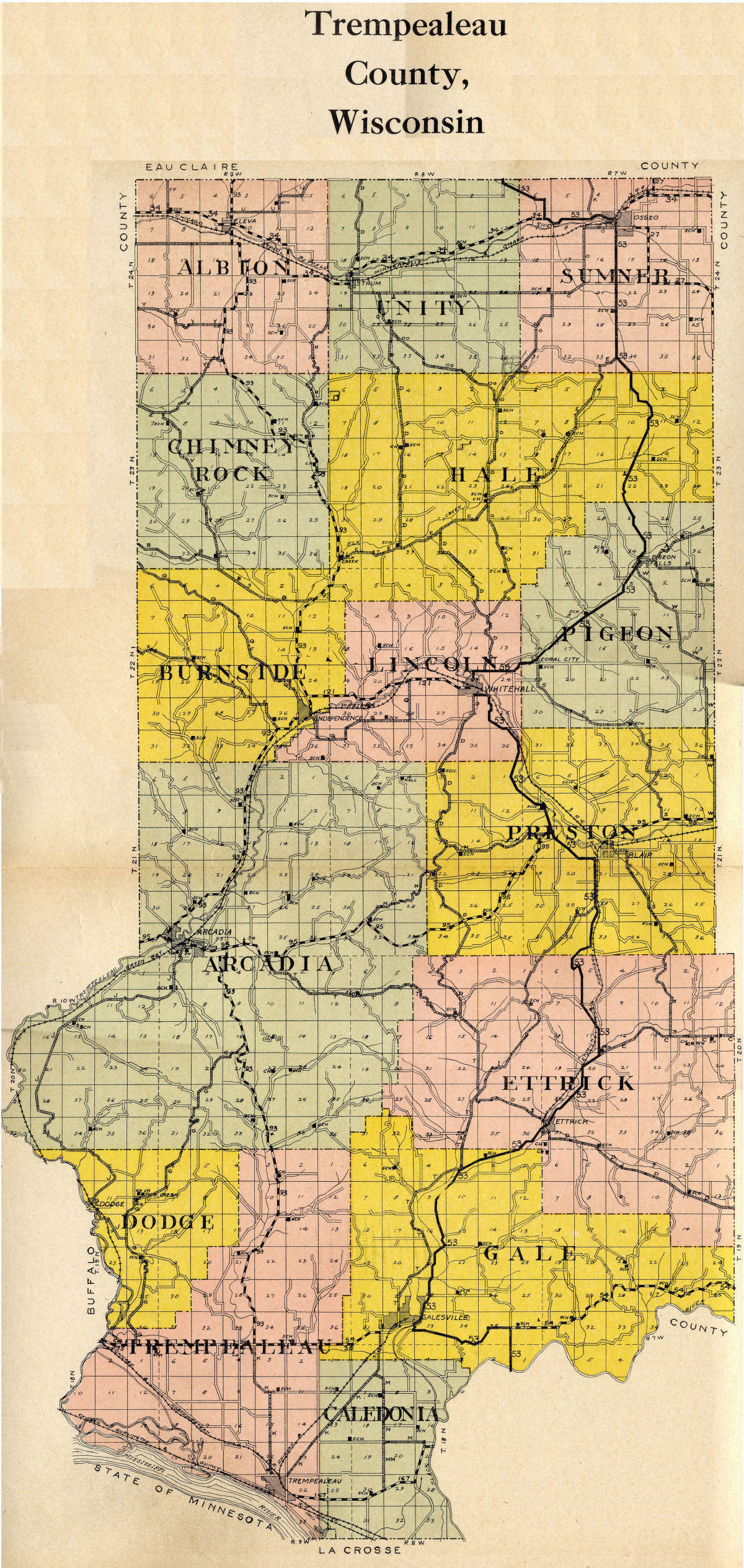
Maps: 1930 Trempealeau Co. WI Atlas Map
Donated by All Parks Genealogy Group of
Florence AZ
The
following map contains links to the individual townships that existed
in 1930 that will open in a new window to view the individual township
maps. An alphabetized
name index has
been compiled and donated to this website to enable researchers to
more easily find their Trempealeau Co. ancestors. You will find
each index for each township or partial township below the individual
township maps.
Also see the 1930
Farmers' Directory
for more complete information about many of the landowners of
Trempealeau Co..
Locations of schools, cemeteries, churches, as well
as names of major roads and railroads at that time are also shown.
PLEASE NOTE: To enable our visitors to better see our maps,
the
Trempealeau Co. masthead and navigation bars have been removed.
This
allows for the maps to be viewed at the best quality
possible while providing a faster download time for our
visitors.

